
Reedy River Report Card 2025
Click on a button to learn more!
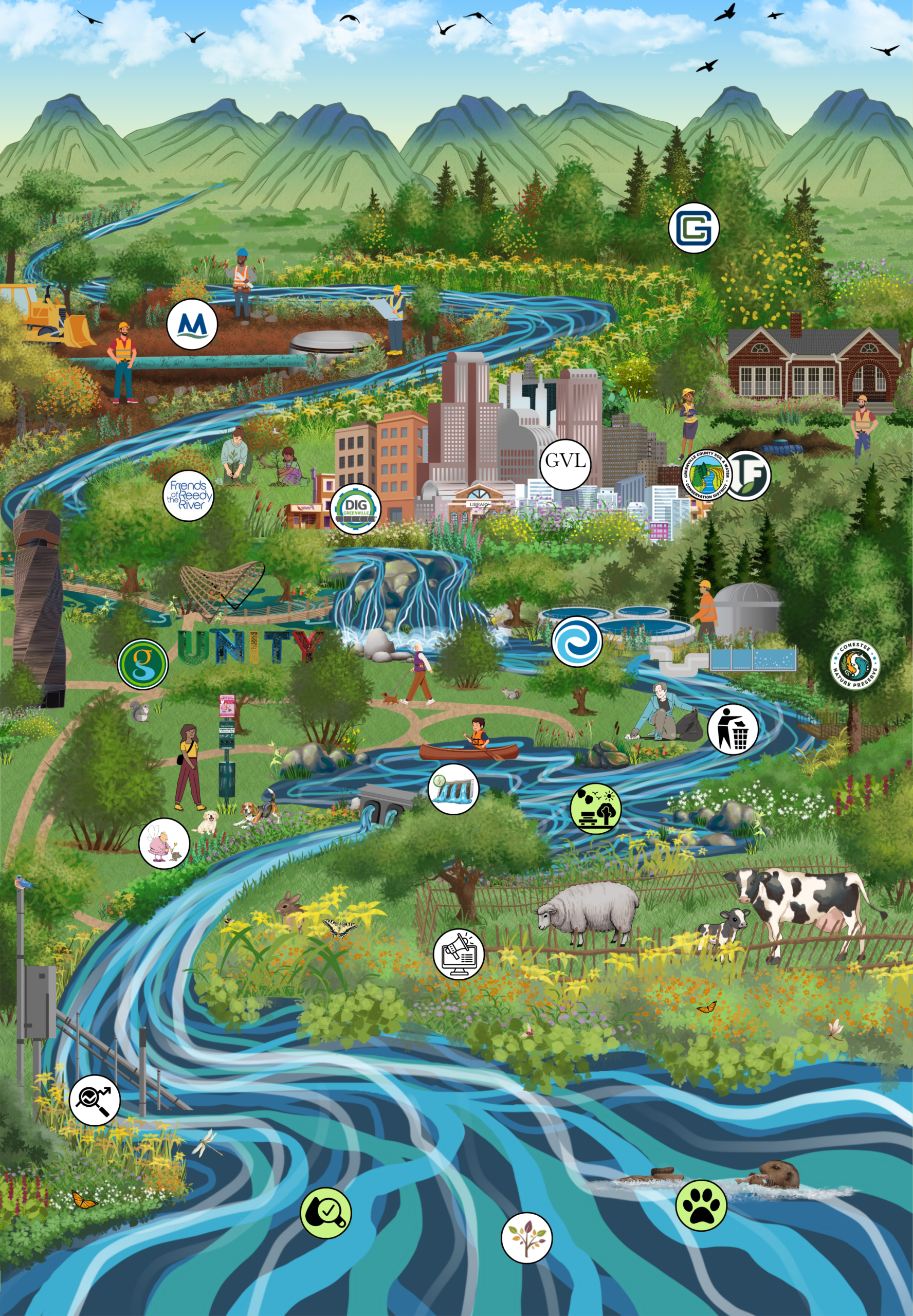
This map serves as an interactive tool to show what projects have been done in the past few years by Reedy River Water Quality Group and participating organizations in order to improve water quality in the Reedy River watershed.
The Reedy, like most rivers, is very different throughout its reach. It starts with spring-fed streams in Travelers Rest. The river then grows in size and velocity as it courses through increasingly urban landscapes through the City of Greenville to Lake Conestee (a current Brownfields site). This reach includes two wastewater treatment plant discharges and two more dams (Cedar Shoals and Boyd Millpond), ending at Lake Greenwood. Within Lake Greenwood, the Reedy River joins the Saluda River, combining as one of our state’s eight major river basins.
Check out Recreation, Water Quality, and Wildlife to see the current health of the Reedy.
-
-
-
Map created by Greenville County Soil & Water Conservation District.
Art credit: Olivia Reed
Website: Olivia Reed, Parth Chauhan
Lake Greenwood
The Reedy River flows into Lake Greenwood! Lake Greenwood is the drinking water source for Laurens and Greenwood. It's our job to keep it clean!